ReKisstory creator
Space Odyssey
2 min to read
Brand new features in Geo Find
Love maps? You can now view and control different maps and satellite images in Geo Find


Wonder of Beautiful Maps
It is handy to see a street map to navigate yourself. We know GoogleMaps is a great tool. But, what if we can select different maps and satellite images and overlay with each other? You would like to analyze geographical data in different views. Here comes our new features.
Many Images with Opacity
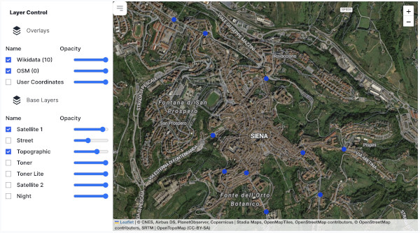
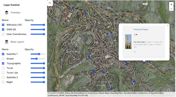
We have the following maps and images to choose from. Don't worry if you cannot pick one, or you need more than one. You can switch them on and off by clicking checkboxes. In addition, you can make them transparent by changing the opacity by the slider.
- Satellite Images
- Street Map
- Topographic Map
- Toner and Toner Lite
- NASA Night View
You need a real one. Bird-eye view of our planet in a photograph
Simply so familiar. Use this map to make sense of where you are.
Elevation matters? Topographic map may be for you to understand the terrain
Simple map may be a good choice for your analysis and print-out
If your analysis is for night activities, night satellite view offers illuminations of city lights
Map Overlay
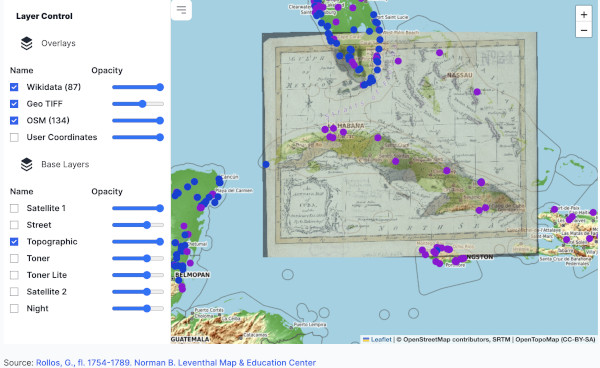
Geo TIFF is an image with coordinates embedded. Our Geo TIFF experiment enables you to view different types of data on top of a modern map. For instance, data can be a historical map (see below) or data plot (locations of damage by explosion in Lebanon). Of course, the great thing is you can plot the ReKisstory's search results on the maps as well. You can think of using this for the following use cases:


- Humanitarian Aid Service
- Environmental and Disaster Assessment
- Archaeological Discovery
- Location Marketing
- Plan your walking trip
- Vicinity Analysis
- Distribution Analysis
Assess how schools and hospitals are affected by the Lebanon explosions in 2020 or where are the houses destroyed by an earth quake
Evaluate the impact of new development near a forest, or find the geographical relationship between river and flooded area.
Analyze where undiscovered archaeological sites would be in relation to other sites, identify gaps between old maps and modern topography
Find the best location for your new shop or marketing campaign
Optimize your next trekking route or city walk tour
Measure the distances of buildings or find the nearest bridge or toilet
Count how many waterfalls there are near a lake, or how many tram stops there are in the city
Use cases are endless. Use your imagination. At the moment, you can only try our pre-selected images, because some Geo TIFF files are too big to handle (over 50MB). We plan to provide a subscription service to allow you to upload Geo TIFF files in the future.
While there is still much to learn and discover through space exploration, we also need to pay attention to our unexplored world here on earth. Our next big leap into the unknown can be every bit as exciting and bold as our pioneering work in space. It possesses the same “wow” factor: alien worlds, dazzling technological feats and the mystery of the unknown.
Philippe Cousteau, Jr. In 'Why Exploring the Ocean is Mankind’s Next Giant Leap', contributed to CNN 'Lightyears Blog' (13 Mar 2012)
Source: Wikipedia